| Tuolumne Fire, Maps and Photos / photo_H-11 |
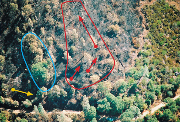
Photo H-11.
View of area above the road and above accident site. Green trees visible to the left edge of photo above road is area of possible helicopter water drops (blue line). In center of photo is area which burned hot (red line) and rapidly (spread direction shown in red arrows) prior to and during accident events. Burning snag (yellow arrow) was located below and to the left of bright green tree above road in lower left corner of photo.