| Tuolumne Fire, Maps and Photos / photo_H-01 |
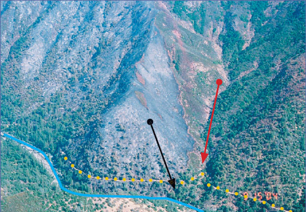
Photo H-1.
View of lower fire area and accident scene. Tuolumne River (blue line) runs from lower left side (upstream) to lower right of photo (down stream) with north to the left of the photo and south to the right. Photo taken generally from west to east. Drew Creek (red arrow) is visible to the right of burned area. Lumsden Road (yellow dotted line) runs above the river on the southeast side and is visible near the bottom of photo. Accident site (black arrow) is located on the slope below the road and just above the river, just inside the right flank.